Mohawk River Valley Region
Mohawk Valley Region's Path Through History
  • About
    • Region
    • Revolutionary War
  • My Path
  • Destinations
  • Bike Routes
  • Themed Itineraries
    • View All Itineriaries
    • Battlefields and Raids
    • Colonial Sites
    • Native Americans in the Revolution
    • Breadbasket of the Revolution
    • Footsteps of Washington
    • Trails to Roads
    • Western Frontier and the Border Wars
  • Events
  • News
  • Partners

Get your free brochure

Like us on Facebook Follow Us On Twitter Follow Us On Youtube Follow Us On Pintrest Follow Us On Instagram

Site Created by Brockett Creative Group, Inc.
Content Powered by tSpark CMS

Mohawk Valley Region's Path Through History
Download Our Brochure I ? NY - iloveny.com

Destinations

Previous Page
Sharon Springs Battlefield

Sharon Springs Battlefield

On July 9, 1781 scouts out of Fort Rensselaer reported to Colonel Marinus Willett that the British were burning Currytown, NY. A force of nearly 300 Indians and Loyalists under Lieutenant John Docksta...

More Info
  • Route 20,
    Sharon Springs, NY, 13459
  • Show on Map
  • Free
Site of Encampment of Johnsons raiders

Site of Encampment of Johnsons raiders

Encampment of Joseph Brant, Indians, Sir John Johnson & Regulars, On Oct. 17, 1780 After Raiding Schoharie & Destroying Kniskerns Dorf.

More Info
  • Route 30A,
    Esperance, NY, 12066
  • Schoharie County
  • Show on Map
  • Free
Site of Iroquois village, Onaquaga

Site of Iroquois village, Onaquaga

Lying south and west of what now the SW corner of Otsego county, the Iroquois settlement at Onaquaga (now North Windsor) was hundreds of years old, a trading post and missionary station. During the 1...

More Info
  • Route 79,
    Windsor, NY, 13865
  • Show on Map
  • Free
Site of Iroquois village, Unadilla

Site of Iroquois village, Unadilla

Site of the historic Iroquois village of Unadilla and marker of the Sullivan-Clinton Campaign route along the Susquehanna River south and west. Raids on old Unadilla and (nearby) Onaquaga occurre...

More Info
  • Route 7,
    Bainbridge, NY, 13733
  • Show on Map
  • Free
Snells Bush Church

Snells Bush Church

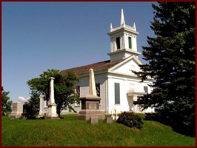
The Snells Bush church was built by the Palatines on a piece of land donated by the Snell family. Originally the land was given to Jacob Zimmerman and Johan Jost Snell, by a land grant given to them f...

More Info
  • Snells Bush Road,
    Little Falls, NY, 13365
  • Show on Map
  • Free
St. John's Episcopal Church (Cemetery)

St. John's Episcopal Church (Cemetery)

Located on the property is the grave of church founder and colonial leader Sir William Johnson, 1st Baronet (1715-1774). It is the second church on this site; the original church having burned in 1836...

More Info
  • 1 N Market Street,
    Johnstown, NY, 12095
  • (518) 762-9210
  • Show on Map
  • Free
Steuben Memorial State Historic Site

Steuben Memorial State Historic Site

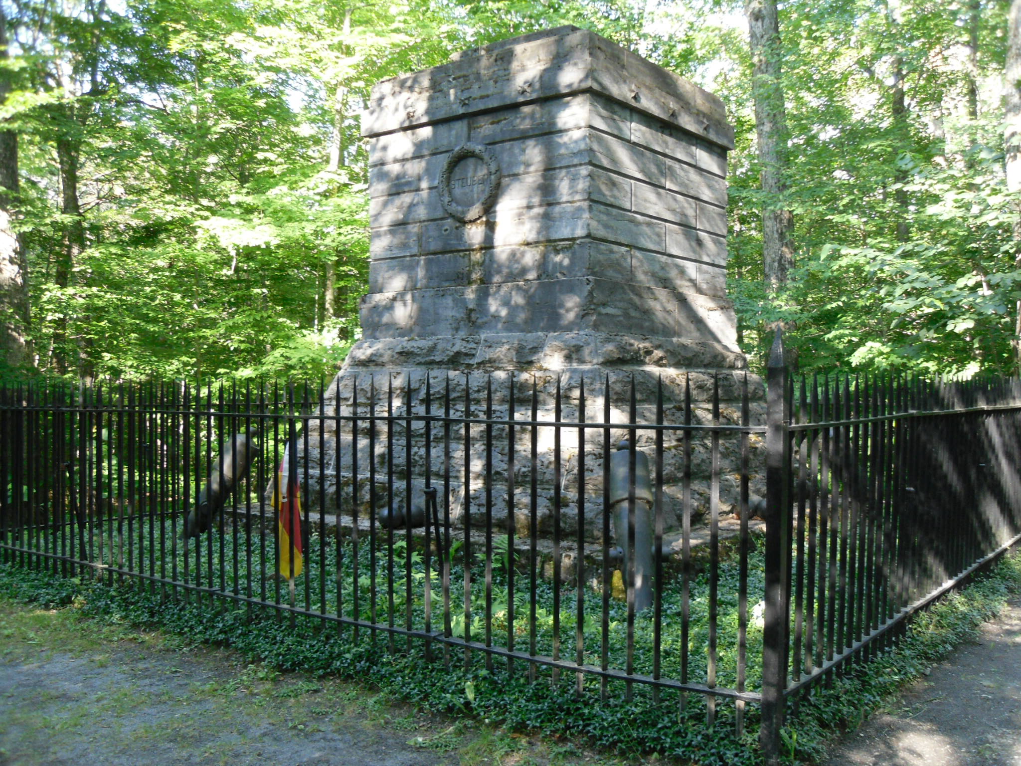
This idyllic upstate NY spot is the historic site and state park honoring the "Drillmaster of the American Revolution" Baron Friedrich Wilhelm Von Steuben. The land in this part of Oneida County wa...

More Info
  • Starr Hill Road,
    Remsen, NY, 13438
  • (315) 831-3737
  • Show on Map
  • Free
Stone Arabia Battlefield

Stone Arabia Battlefield

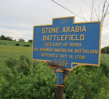
On October 19, 1780 Sir John Johnson led an army of 900 Loyalist and British Regulars on an invasion of the Mohawk Valley. After following a circuitous route across southern New York State they swept ...

More Info
  • Route 10,
    Stone Arabia, NY, 13339
  • Show on Map
  • Free
Sullivan Expedition Marker

Sullivan Expedition Marker

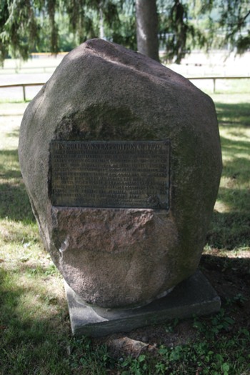
“ In Sullivan's Expedition of 1779... which destroyed Indian Savagery and opened the westward pathway of civilization the New York Brigade, General James Clinton commanding, consisting of the 3rd, 4t...

More Info
  • Neahwa Park,
    Oneonta, NY, 13820
  • Show on Map
  • Free
Swart Tavern Marker

Swart Tavern Marker

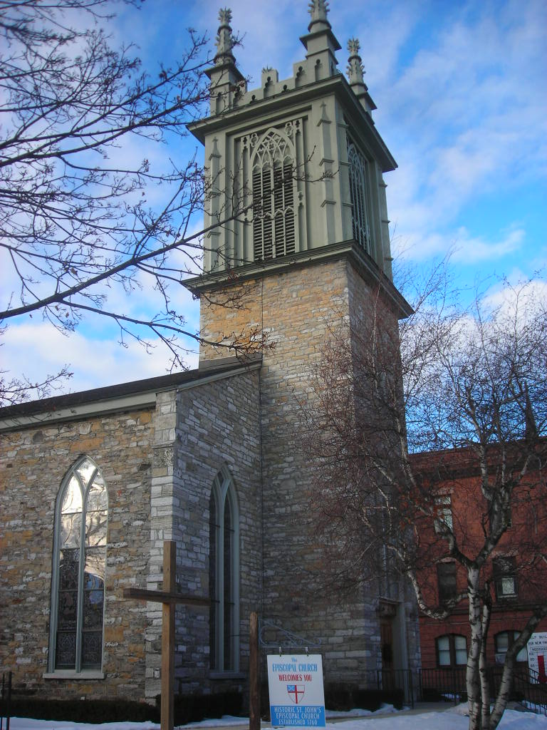
Erected about 1772. It became a place where stagecoach travelers stopped to rest and eat on their way from Schenectady to Utica. Duel between Philip Schuyler and Josiah Clark fought in back of buildin...

More Info
  • State Route 30,
    Schoharie, NY, 12157
  • Schoharie County
  • Show on Map
  • «
  • 1
  • …
  • 6
  • 7
  • 8
  • »

May 1 - May 31

Col. Staats Long Morris makes a trip to "The Butternuts" in present day Otsego County to settle tenants

Join Our Mailing List

This field is required.

Recommended For You

Like us on Facebook Follow Us On Twitter Follow Us On Youtube Follow Us On Pintrest Follow Us On Instagram

Path Through History
I love NY

Site Map / Privacy Policy / Contact US

Site Created by Brockett Creative Group, Inc.

Content Powered by tSpark CMS